
Realtime data from the OOI instruments at Axial Seamount
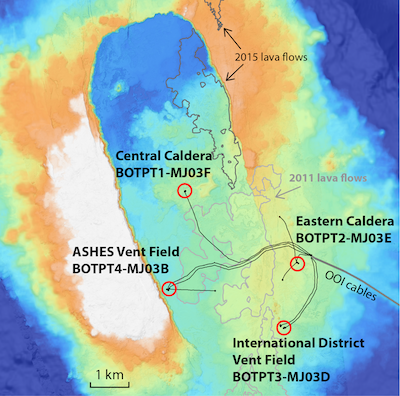
The maps below show the locations of four sets of Bottom Pressure/Tilt (BOTPT) and Conductivity/Temperature/Depth (CTD) instruments at Axial Seamount, part of the National Science Foundation's (NSF) Ocean Observatories Initiative (OOI) Regional Cabled Array (RCA), operated by the University of Washington. Click on the "DATA" links (below right) to see plots of real-time data (updated every 15 minutes) from the BOTPT and seafloor CTD instruments. The BOTPT instruments were built by NOAA's Pacific Marine Environmental Lab and Oregon State University. Related websites follow our attempts to use the monitoring data to forecast the next eruption partly using the "INFLATION FORECASTS" pages (links below left). Another website has information on previous expeditions to Axial Seamount. Finally, there is a simplified STATUS page showing whether or not Axial has erupted yet.
 |
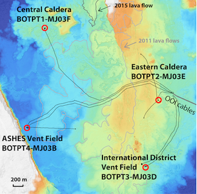 |
| Map of Axial caldera with OOI cables (black lines), recent lava flows (grey outlines), and locations of BOTPT instruments (red circles). | Map of Axial caldera with OOI cables (black lines), recent lava flows (grey outlines), and locations of BOTPT instruments (red circles). |